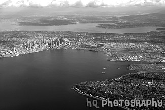
Aerial View of Seattle, Washington Photo in Black and White

This is an aerial view of Seattle, Washington taken from an airplane flying into the SeaTac Airport. From this photo you can see the city of Seattle, the tall buildings, the Space Needle, and the bay and water. You can also see the Seahawks and the Mariner's stadiums. From this photo you can actually see it ALL! You can see I90, 520, Lake Washington, and Lake Sammamish in the far distance!
Related Photos
aerial seattle, washington, flying over seattle, view city seattle from sky, aerial view buildings, aerial view clouds over seattle, entire city seattle, seattle taken from an airplane, aerial puget sound, washington, puffy clouds
Related Photos
aerial seattle, washington, flying over seattle, view city seattle from sky, aerial view buildings, aerial view clouds over seattle, entire city seattle, seattle taken from an airplane, aerial puget sound, washington, puffy clouds
Camera Settings (EXIF Data)
- Shutter Speed: 1/200 seconds
- Lens Aperture: F/8
- Focal Length: 28 mm
- Image Resolution: 2865 x 1906 pixels
- Image Size: 3.36 MB (JPG), 15.6 MB (TIF)
- Date Photo Taken: October 30, 2004 2:24 PM
- File Name: seattle26.jpg
- Image ID: # 258
- Date added to website: 17-Nov-2004
Even more stuff
- Large Poster Format
- Request an image
- Free wallpaper collection
- Return Policy
- Questions? Contact HQ Photography.
