Home > Places > Lakes (Digital Paintings)

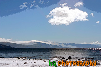
Beautiful scenic view of lake tahoe taken right after a snow storm. This photo is gorgeous because of the blue skies contrasting the freshly fallen snow covereing the shore and beach.
Image #285 | 3035 x 2014 pixels | 3.27 MB (jpg) | 17.5 MB (tif)
Beautiful Lake Tahoe Snow View


A pretty view of the moon rising at Lake Tahoe during July 2004. Lake Tahoe is the second deepest lake in the United States and the tenth deepest in the world, with a maximum depth measured at 1,645 ft (501 m), average depth of 1,000 ft (305 m). The Lake Tahoe Basin was formed by geologic block (normal) faulting about 2 to 3 million years ago. A geologic block fault is a fracture in the Earth's crust causing blocks of land to move up or down. Snow, rain, and streams filled the southern and lowest part of the basin, forming the ancestral Lake Tahoe. Modern Lake Tahoe was shaped and landscaped by the scouring glaciers during the Ice Age. Many streams flow into Lake Tahoe, but the lake is drained only by the Truckee River, which flows northeast through Reno and into Pyramid Lake in Nevada.
Image #194 | 2592 x 1944 pixels | 2.16 MB (jpg) | 14.4 MB (tif)
Lake Tahoe - Moon Rising

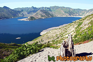
A scenic picture taken of Spirit Lake which is located right by Mount St. Helens which is in Gifford Pinchot National Forest, Washington. This picture is taken looking in the opposite direction of Mount St. Helens towards Mt. Rainier which you can see the tip of over the hill in the right corner. Spirit Lake is situated across the blast path of Mount St Helens and is one of the enduring features of the devastation of the 1980 Mount St. Helens eruption. Floating over the surface of the water is a forest of destroyed trees. Just over two decades after the eruption, Spirit Lake has seen drastic changes. Once, it used to be a recreational outpost for children and adults of all ages. Now, due to the floating forest and other factors, the lake has become a tourist attraction that remains evidence of the Mount St. Helens eruption. Spirit Lake was once part of an ideal picture-postcard setting, with Spirit Lake in foreground and snowcapped Mt. Saint Helens as a backdrop. The scene at Spirit Lake changed dramatically on May 18, 1980, when the Mt. Saint Helens volcano erupted after being dormant for 123 years, sending a deep blanket of ash upon the lake and destroying the beautiful scene.
Image #538 | 3504 x 2336 pixels | 6.03 MB (jpg) | 23.4 MB (tif)
Spirit Lake, Gifford Pinchot National Forest

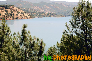
A scenic picture taken of a boat floating in Don Pedro Reservoir near the historic town of Jacksonville, California. Nestled in the Sierra-Nevada foothills east of Modesto, California, Don Pedro Reservoir/Lake is the sixth-largest body of water in California. When full, the reservoir is 26-miles-long, has a capacity of more than two million acre-feet and 160 miles of shoreline. The reservoir and dam were built with multiple benefits in mind: water storage, power generation, flood control and recreation.
Image #651 | 3504 x 2336 pixels | 6.17 MB (jpg) | 23.4 MB (tif)
Boat in Don Pedro Reservoir

A scenic photo taken of a lake out in the country side of the sate of California. This lake is a popular campground for many outdoor people. It is located on the out-skirts of the bay area, east of San Francisco more towards Sacramento.
Image #15 | 1024 x 768 pixels | 580 KB MB (jpg) | 2.25 MB (tif)
California Lake
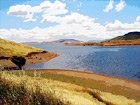

A scenic photo of a lake scene taken in Northern California on a partly cloudy day.
Image #45 | 1600 x 1200 pixels | 706 KB MB (jpg) | 5.49 MB (tif)
California Lake Scene

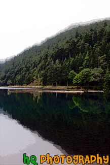
A scenic vertical picture taken of a hill and its' reflection seen in Lake Cresent, located in the Olympic National Park.
Image #1704 | 2336 x 3504 pixels | 3.61 MB (jpg) | 23.4 MB (tif)
Hill Reflection in Lake

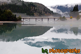
A scenic picture taken of Diablo Lake and the surrounding northern cascade mountains in the background which are reflecting in the lake. You can see some fog in the reflection and surrounding the lake.
Image #2050 | 3504 x 2336 pixels | 4.08 MB (jpg) | 23.4 MB (tif)
Lake & Mountain Reflection
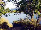

A photo of a lake looking through some trees and branches. This photo was taken at a campground in Northern California.
Image #46 | 1024 x 768 pixels | 554 KB MB (jpg) | 2.25 MB (tif)
Lake & Scenic Trees

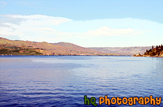
A scenic picture taken of Lake Chelan which is located in central Washington State, nestled in the North Cascades National Forest. The Chelan Valley encompasses the communities of Chelan, Manson & Stehekin. Lake Chelan is a 50.5 mile glacier-fed lake and is 1.5 miles at its widest. 1486 feet is its deepest point.
Image #1984 | 3429 x 2260 pixels | 5.29 MB (jpg) | 22.2 MB (tif)
Lake Chelan

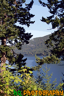
A scenic vertical picture taken of Lake Cresent in the background seen through some green trees in the foreground. This photo was taken on a sunny day in the Olympic Mountains.
Image #1703 | 2336 x 3504 pixels | 6.12 MB (jpg) | 23.4 MB (tif)
Lake Cresent and Trees

A view of Lake Shasta, California while driving North on I5. You can tell this photo was taken while the car was moving because the trees in the foreground are blurry but the lake itself is in focus.
Image #67 | 1600 x 1200 pixels | 1.19 MB (jpg) | 5.49 MB (tif)
Lake Shasta from I5


A pretty view at Lake Tahoe during July 2004. Lake Tahoe is the second deepest lake in the United States and the tenth deepest in the world, with a maximum depth measured at 1,645 ft (501 m), average depth of 1,000 ft (305 m). The Lake Tahoe Basin was formed by geologic block (normal) faulting about 2 to 3 million years ago. A geologic block fault is a fracture in the Earth's crust causing blocks of land to move up or down. Snow, rain, and streams filled the southern and lowest part of the basin, forming the ancestral Lake Tahoe. Modern Lake Tahoe was shaped and landscaped by the scouring glaciers during the Ice Age. Many streams flow into Lake Tahoe, but the lake is drained only by the Truckee River, which flows northeast through Reno and into Pyramid Lake in Nevada.
Image #195 | 2592 x 1944 pixels | 2.95 MB (jpg) | 14.4 MB (tif)
Lake Tahoe - Sand & Boats


A pretty view at Lake Tahoe of a sand castle and boat during July 2004. Lake Tahoe is the second deepest lake in the United States and the tenth deepest in the world, with a maximum depth measured at 1,645 ft (501 m), average depth of 1,000 ft (305 m). The Lake Tahoe Basin was formed by geologic block (normal) faulting about 2 to 3 million years ago. A geologic block fault is a fracture in the Earth's crust causing blocks of land to move up or down. Snow, rain, and streams filled the southern and lowest part of the basin, forming the ancestral Lake Tahoe. Modern Lake Tahoe was shaped and landscaped by the scouring glaciers during the Ice Age. Many streams flow into Lake Tahoe, but the lake is drained only by the Truckee River, which flows northeast through Reno and into Pyramid Lake in Nevada
Image #197 | 2592 x 1944 pixels | 2.94 MB (jpg) | 14.4 MB (tif)
Lake Tahoe - Sand Castle & Boat
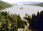

View of Lake Tahoe from high in the mountains looking over Emerald Bay. Lake Tahoe is the second deepest lake in the United States and the tenth deepest in the world. The Lake Tahoe Basin was formed by geologic block (normal) faulting about 2 to 3 million years ago. Snow, rain, and streams filled the southern and lowest part of the basin, forming the ancestral Lake Tahoe. Modern Lake Tahoe was shaped and landscaped by the scouring glaciers during the Ice Age. Many streams flow into Lake Tahoe, but the lake is drained only by the Truckee River, which flows northeast through Reno and into Pyramid Lake in Nevada.
Image #19 | 1001 x 711 pixels | 367 KB MB (jpg) | 2.04 MB (tif)
Lake Tahoe and Emerald Bay

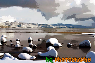
A scenic picture taken of Lake Tahoe right after a huge snow storm. Interesting and dramatic clouds are hovering in the skies above Lake Tahoe along with snow covering the rocks on the shore. On this particular day there was about a foot of snow that dropped down from the skies. A beautiful picture of what it is like in the winters at Lake Tahoe.
Image #284 | 2936 x 1969 pixels | 3.51 MB (jpg) | 16.5 MB (tif)
Lake Tahoe Clouds and Snow

A pretty view of a some big rocks in Lake Tahoe. Lake Tahoe is the second deepest lake in the United States and the tenth deepest in the world, with a maximum depth measured at 1,645 ft (501 m), average depth of 1,000 ft (305 m). The Lake Tahoe Basin was formed by geologic block (normal) faulting about 2 to 3 million years ago. Snow, rain, and streams filled the southern and lowest part of the basin, forming the ancestral Lake Tahoe. Modern Lake Tahoe was shaped and landscaped by the scouring glaciers during the Ice Age. Many streams flow into Lake Tahoe, but the lake is drained only by the Truckee River, which flows northeast through Reno and into Pyramid Lake in Nevada.
Image #17 | 1001 x 739 pixels | 546 KB MB (jpg) | 2.12 MB (tif)
Lake Tahoe Rocks

A pretty view at Lake Tahoe looking through the trees of the mountains during July 2004. Lake Tahoe is the second deepest lake in the United States and the tenth deepest in the world, with a maximum depth measured at 1,645 ft (501 m), average depth of 1,000 ft (305 m). The Lake Tahoe Basin was formed by geologic block (normal) faulting about 2 to 3 million years ago. A geologic block fault is a fracture in the Earth's crust causing blocks of land to move up or down. Snow, rain, and streams filled the southern and lowest part of the basin, forming the ancestral Lake Tahoe. Modern Lake Tahoe was shaped and landscaped by the scouring glaciers during the Ice Age. Many streams flow into Lake Tahoe, but the lake is drained only by the Truckee River, which flows northeast through Reno and into Pyramid Lake in Nevada.
Image #199 | 2592 x 1944 pixels | 3.37 MB (jpg) | 14.4 MB (tif)
Lake Tahoe Through Trees

A pretty view of Lake Tahoe during Spring 2003. Lake Tahoe is the second deepest lake in the United States and the tenth deepest in the world, with a maximum depth measured at 1,645 ft (501 m). In this photo you can see a big rock on the right and the see through water of the lake. Mountains are also visible that surround the lake.
Image #18 | 1024 x 768 pixels | 325 KB MB (jpg) | 2.25 MB (tif)
Lake Tahoe Waters
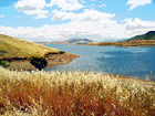

A landscape scene in Northern California near Gilroy of a lake and puffy clouds on a sunny day.
Image #44 | 1600 x 1200 pixels | 927 KB MB (jpg) | 5.49 MB (tif)
Landscape Lake Scene

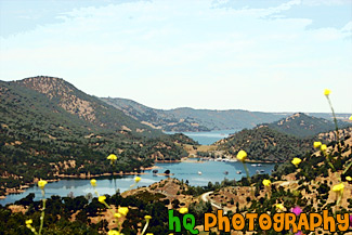
Moccasin Point Marina can be seen on your drive to Yosemite National Park if you take Highway 120 (Yosemite Highway). Moccasin, California is situated in the foothills of California's beautiful Sierra Nevada Mountains. Moccasin Point Marina and recreation area is 60 miles west of the Yosemite National Park and 2 1/2 hours east of San Francisco.
Image #650 | 3504 x 2336 pixels | 4.98 MB (jpg) | 23.4 MB (tif)
Moccasin Point Marina, California

A pretty view at Lake Tahoe during July 2004. Lake Tahoe is the second deepest lake in the United States and the tenth deepest in the world, with a maximum depth measured at 1,645 ft (501 m), average depth of 1,000 ft (305 m). The Lake Tahoe Basin was formed by geologic block (normal) faulting about 2 to 3 million years ago. A geologic block fault is a fracture in the Earth's crust causing blocks of land to move up or down. Snow, rain, and streams filled the southern and lowest part of the basin, forming the ancestral Lake Tahoe. Modern Lake Tahoe was shaped and landscaped by the scouring glaciers during the Ice Age. Many streams flow into Lake Tahoe, but the lake is drained only by the Truckee River, which flows northeast through Reno and into Pyramid Lake in Nevada.
Image #205 | 2592 x 1944 pixels | 1.69 MB (jpg) | 14.4 MB (tif)
Overall View of Lake Tahoe

A pretty view at Lake Tahoe during July 2004. Lake Tahoe is the second deepest lake in the United States and the tenth deepest in the world, with a maximum depth measured at 1,645 ft (501 m), average depth of 1,000 ft (305 m). The Lake Tahoe Basin was formed by geologic block (normal) faulting about 2 to 3 million years ago. A geologic block fault is a fracture in the Earth's crust causing blocks of land to move up or down. Snow, rain, and streams filled the southern and lowest part of the basin, forming the ancestral Lake Tahoe. Modern Lake Tahoe was shaped and landscaped by the scouring glaciers during the Ice Age. Many streams flow into Lake Tahoe, but the lake is drained only by the Truckee River, which flows northeast through Reno and into Pyramid Lake in Nevada.
Image #202 | 2592 x 1944 pixels | 2.12 MB (jpg) | 14.4 MB (tif)
Shadow over the Mountains, Lake Tahoe
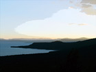

A pretty view at Lake Tahoe during July 2004. Lake Tahoe is the second deepest lake in the United States and the tenth deepest in the world, with a maximum depth measured at 1,645 ft (501 m), average depth of 1,000 ft (305 m). The Lake Tahoe Basin was formed by geologic block (normal) faulting about 2 to 3 million years ago. A geologic block fault is a fracture in the Earth's crust causing blocks of land to move up or down. Snow, rain, and streams filled the southern and lowest part of the basin, forming the ancestral Lake Tahoe. Modern Lake Tahoe was shaped and landscaped by the scouring glaciers during the Ice Age. Many streams flow into Lake Tahoe, but the lake is drained only by the Truckee River, which flows northeast through Reno and into Pyramid Lake in Nevada.
Image #201 | 2592 x 1944 pixels | 1.63 MB (jpg) | 14.4 MB (tif)
Sky, Mountains, and Sunset of Lake Tahoe

